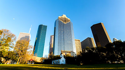
The Maps and Transportation section of the Greater Houston Hotels and Visitors Bureau website includes interactive maps and information on public transportation around the city.
METRO Trains and Buses
It’s easy to use METRO trains and buses to navigate throughout the town, especially from and within the Medical Center. Check out route schedules on the METRO site and check out safety tips. If you ride METRO often, you’ll want to look into getting a METRO Q fare card.
Biking
Many individuals ride bicycles to school or work in the Medical Center. If you decide to bike, you’ll want to familiarize yourself with bicycling laws and bike trails around Houston. Biking in the Medical Center will include biking on the streets, but the Braes Bayou Bike Trail follows Braes Bayou from Gessner, past the TMC, almost all the way to the University of Houston.
There are several bike racks around Baylor, including inside the entrance to Garage 6, behind the Jewish wing, and in front of the DeBakey building.
Roads
Take a look at this map of Houston to get familiar with the area. Sometimes, roads can change names on you. Some roads near the Medical Center to know include:
- Bellaire becomes Holcombe (at Buffalo Speedway)
- S. Braeswood becomes N. MacGregor Drive (at Holcombe)
- N. Braeswood runs into Beechnut (at the West Loop)
- Stella Link Road becomes Weslayan (at Holcombe)
- Montrose becomes Studemont (at Allen Parkway) and Studewood (at I-10)
- Hillcroft becomes Voss (at Westheimer) and then Bingle (at I-10)
- Elgin (downtown) becomes Westheimer
- Kirby becomes Allen Parkway (at Shepherd Dr.)
Freeways
Houston freeways may seem a little intimidating if you’re not used to fast-paced traffic, and they get very congested during rush hour or if there’s construction going on. Make sure you keep yourself updated and on top of construction. Keep in mind that almost all Houston freeways have feeder roads, which are continuous roads that run alongside the freeways and feed onto or off the freeways. Also, most of the freeways have local names, which are good to know:
- I-45 (north of downtown) = North Freeway
- I-45 (south of downtown) = Gulf Freeway
- I-10 (east of downtown) = East Freeway
- I-10 (west of downtown) = Katy Freeway
- 59 (north of downtown) = Eastex Freeway
- 59 (south of downtown) = Southwest Freeway
- I-610 = The Loop (N., E., S., and W.)
Need a ride?
All the major ride share apps are active in Houston. There are also local taxi companies such as Yellow Cab at (713) 236-111 or United Cab at (713) 699-0000.
Airports
Houston has two major airports: Bush Intercontinental Airport (IAH) and Hobby Airport (HOU). Bush, an international airport, is about a 45-minute drive from the Medical Center in typical traffic. Hobby, a domestic airport, is about a 25-minute drive from the Medical Center.
You can park at the airport or catch a SuperShuttle.
*Please note that Baylor College of Medicine is not providing endorsements, but an informational reference list. If you have any recommendations for additional information, please email commuter@bcm.edu.
Parking at Texas Medical Center
The closest parking garages to BCM are Garage 6 or Garage 4. See Texas Medical Center Parking to see the best place to park for other places around the Medical Center.


